
7.7 Magnitude Earthquake Strikes Eastern Indonesia
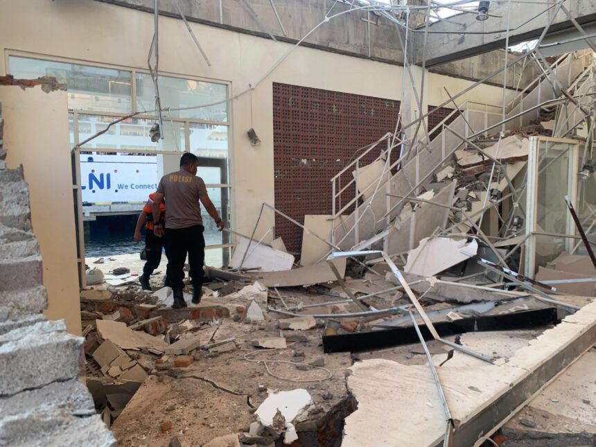
A powerful 7.7 magnitude earthquake rocked eastern Indonesia early Saturday, resulting in at least 38 fatalities and widespread panic among residents. The quake triggered the collapse of buildings and homes in a region known for its seismic activity.
Details of the Earthquake
The earthquake was recorded at 5:58 a.m. local time (21:58 GMT) with its epicenter located at 8.41 degrees south latitude and 121.39 degrees east longitude, and at a depth of 15 kilometers (9.32 miles). The US Geological Survey confirmed the shallow nature of the quake, placing it at a depth of 10 kilometers in the Flores region.
The tremor was significant enough to instigate a tsunami warning from Indonesia’s Meteorology, Climatology and Geophysics Agency, which was later lifted. The agency initially recorded the earthquake’s magnitude at 7.67, while the German Research Centre for Geosciences estimated it at the same level before alterations were made following further assessments.
Following the main quake, residents experienced additional tremors with two aftershocks, the strongest measuring 6.1 in magnitude. Reports indicate that the strong shaking caused residents to flee their homes, seeking refuge in the streets amid fears of further tremors.
Rescue Efforts Underway
Rescue teams are currently engaged in damage assessment and casualty report collection across the affected regions of Flores Island. As emergency response efforts continue, additional updates are anticipated regarding the impact of this devastating disaster. Local authorities are working to bolster the support systems necessary for affected families during this crisis.
Indonesia, located on the Pacific “Ring of Fire,” is susceptible to frequent seismic activity due to its geology rich in volcanoes and fault lines. This location explains the heightened risk and emphasizes the need for ongoing preparedness in the face of natural disasters.
Why It Matters
This earthquake is a stark reminder of Indonesia’s vulnerability to seismic events, highlighting the importance of earthquake preparedness and resilient infrastructure in high-risk zones. The event can also have lasting socio-economic impacts, complicating recovery and potentially displacing communities. Additionally, international emergency response efforts may be required as the full extent of the damage becomes clearer. Understanding these dynamics can aid global preparedness and response strategies for natural disasters.
Frequently Asked Questions
What was the magnitude of the earthquake?
The earthquake was measured at a magnitude of 7.7, with an initial estimation by the German Research Centre for Geosciences at 7.67 before a revised assessment placed it at 7.7.
Where was the epicenter located?
The epicenter of the earthquake was registered at 8.41 degrees south latitude and 121.39 degrees east longitude, situated in the Flores region of eastern Indonesia.
Were there any aftershocks?
Yes, the main earthquake was followed by two aftershocks, with one recorded at 6.1 magnitude, causing further distress among residents already shaken by the initial tremor.
What impact did the earthquake have on local communities?
The earthquake resulted in at least 38 fatalities and caused significant structural damage, leading to panic as residents fled to the streets. Rescue operations are currently ongoing to assess the damage and support affected communities.