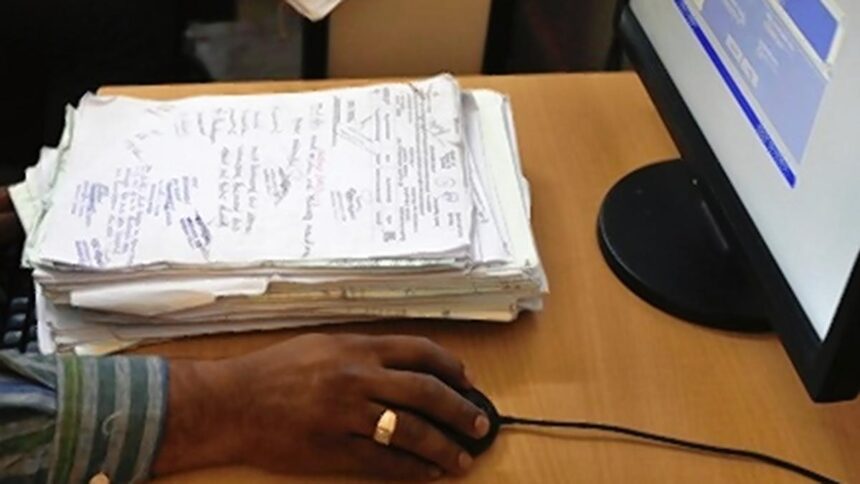
GUWAHATI: The Bodoland Territorial Region (BTR) in Assam has achieved a landmark milestone by becoming the first tribal council operating under the Sixth Schedule of the Constitution to fully digitize its land records. Officials reported that the digitization process, which involved over 1.5 million land documents, including texts and maps, covering the 8,970 sq. km BTR, was completed recently, marking an end to decades of manual record-keeping.
There are ten tribal councils governed under the Sixth Schedule in the northeastern states; Assam, Meghalaya, and Mizoram each have three councils, while Tripura has one. Notably, two of Assam’s councils, Karbi Anglong-West Karbi Anglong and Dima Hasao, were established around five decades ago, prior to the formation of the Bodoland Territorial Council (BTC) in 2003.
The BTC manages the BTR, which includes five districts located in the northern and western parts of Assam. The Sixth Schedule grants special provisions for administering tribal areas, empowering autonomous councils with the authority to regulate matters related to land, forests, and local governance. Despite this, these councils have frequently encountered challenges such as insufficient resources, inadequate infrastructure, and administrative difficulties.
Officials stated that the BTR government’s implementation of technology-driven governance systems, including an e-office setup, exemplifies a proactive approach to addressing these challenges in line with the objectives of the Digital India Mission. BTC Secretary Dhiraj Saud noted that the digitization effort commenced in 2023, with the aim of increasing transparency in land ownership and simplifying customs related to landholding.
“This initiative involved on-the-ground surveys across all subdivisions of Baksa, Chirang, Kokrajhar, Tamulpur, and Udalguri districts. Old land records, some of which dated back several decades, were digitized and cross-verified with existing revenue records and maps,” he explained.
Geographic Information System (GIS) mapping was incorporated to ensure the accuracy of land boundaries. The digitization initiative also aligned with the Mission Bwismwuthi 2.0 launched by the Pramod Boro-led BTR government earlier this year, which provided land rights to 47,000 landless indigenous families, including 9,000 small tea growers and rubber farmers. In the first phase of Mission Bwismwuthi, which offers 14 land-related services, over 211,000 applications were successfully processed.
The new digital platform allows farmers, landowners, and residents to verify land status via kiosks, mobile applications, and web portals. “Land disputes have often led to social tensions in our area. By digitizing records, we are fostering transparency and reducing opportunities for corruption, forgery, and conflict,” a Revenue Department official stated.
According to officials, the digitization of land records and the implementation of the e-office system in the BTR have emerged as a model for other autonomous councils in the northeast.
Published – September 03, 2025 04:37 pm IST